About Course
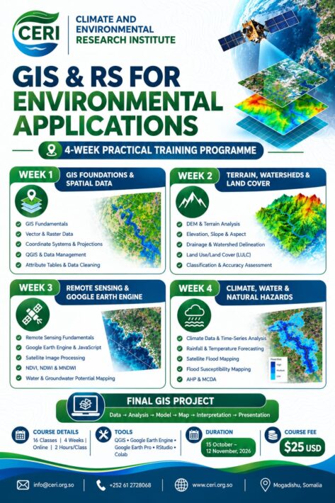
🎯 FINAL GIS PROJECT
Data → Analysis → Model → Map → Interpretation → Presentation
16 Classes | 4 Weeks | Online | 2 Hours/Class
Tools: QGIS • Google Earth Engine • Google Earth Pro • RStudio • Google Colab
Duration: 15 October – 12 November 2026
Course Content
WEEK 1 — GIS FOUNDATIONS & SPATIAL DATA
-
Class 1. GIS Fundamentals & Environmental Applications
35:35 -
Class 2. Vector & Raster Data + Spatial Data Management
15:49 -
Class 3. Coordinate Systems, Projections & Georeferencing
24:09 -
Class 4. QGIS, Attribute Tables & Data Cleaning
53:05
WEEK 2 — TERRAIN, WATERSHEDS & LAND COVER
WEEK 3 — REMOTE SENSING & GOOGLE EARTH ENGINE
WEEK 4 — CLIMATE, WATER & NATURAL HAZARDS
Student Ratings & Reviews

No Review Yet